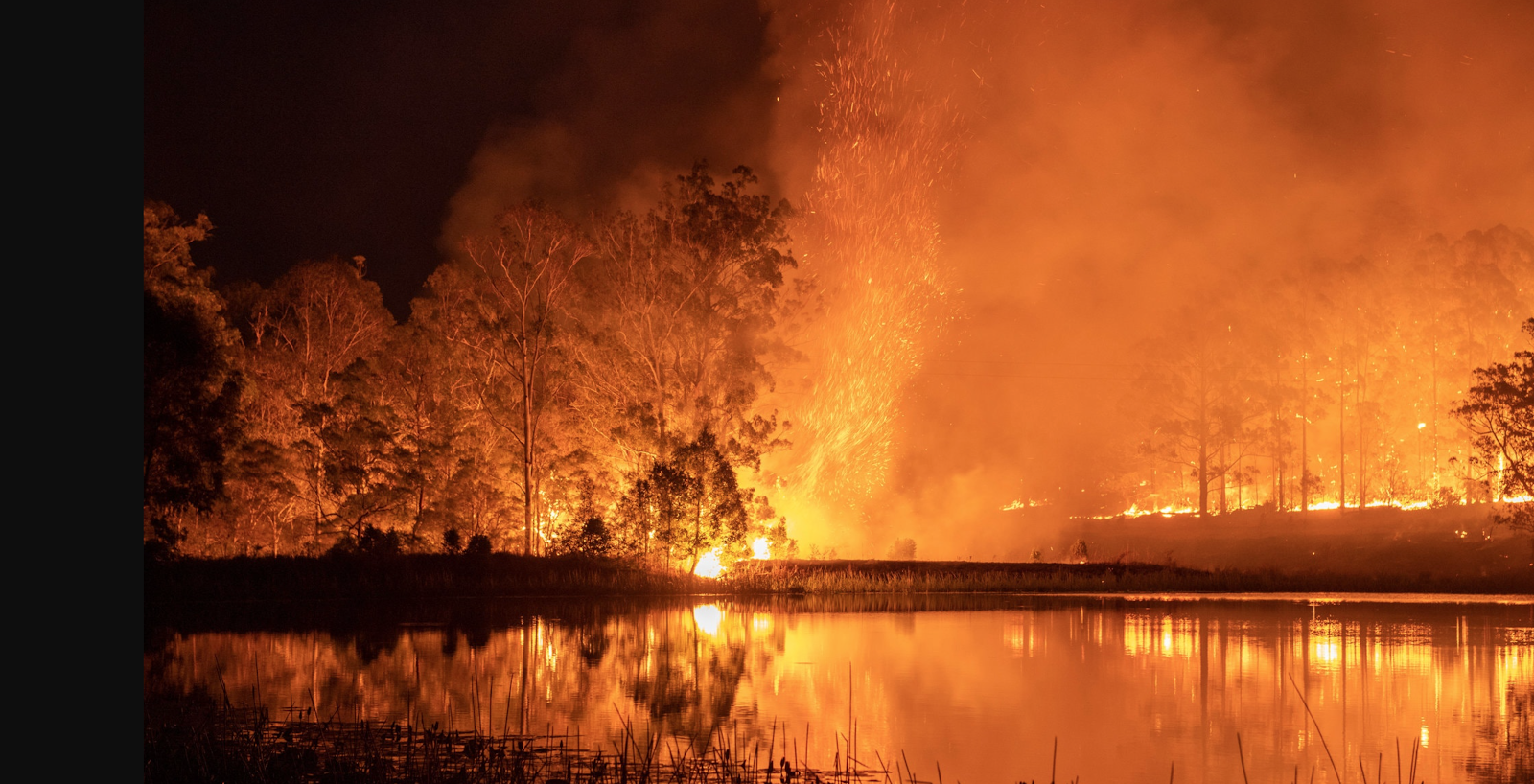
The 2019-20 summer brought with it record breaking temperatures and catastrophic bushfires throughout Australia. With approximately 46,000,000 acres of land burned, 9,300 homes destroyed and over 450 deaths, making sure you have an emergency plan for the coming summer is imperative for protecting your home. In this article we’re going to outline a few of the ways you can prepare your home for potential bushfires in the summer of 2020-21.
How Can I Prepare My Home For The Coming Bushfire Season?
Regardless of what your evacuation plan is in a fire, by carefully planning and preparing your home for a potential bushfire it will be far more likely to withstand it. Of course, firefighters will do their best to prevent your property from going up in flames, but there are a few key maintenance tips you can do to give your home the best chance of survival:
- Clear away excess foliage – If you have leaves and fallen branches scattered throughout your gutters, lawn and property, it’s of utmost importance you clear it. This is important because dry leaves and twigs will stimulate a fire if it were to sweep through your land.
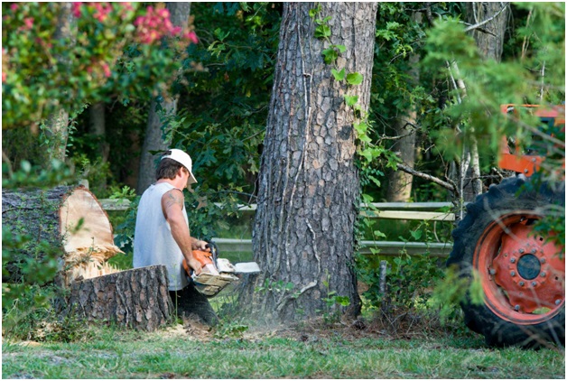
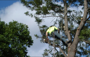
- Get highly flammable trees removed – Although not commonly known, palm trees and eucalyptus trees are highly flammable and commonly found in Australia. If you have a multitude of these trees close to your home, consider getting them removed.
- Plant fire-resistant trees – Fire resistant trees that have moisture rich textures can act as radiant protection and catch embers that would otherwise spread to your home.
- Fire-proof your gutters – In addition to ensuring the tiles of your roof are up-to-scratch, it’s highly advised you install metal gutter guards or fire sprinkler systems to help mitigate flames.
- Mow your grass – Although simple, keeping your lawn short and tidy makes it harder for flames to traverse.
- Clearly indicate where firefighters can find water – If you have a pool, dam or water tank, display signage so your firefighters can easily identify where they can find a source of water they can use to extinguish flames.
What Areas Were Worst Hit By the 2019-20 Bushfires?
Regions of New South Wales, South-Eastern Queensland and Adelaide Hills were heavily impacted by the 2019-20 bushfires. Approximately 46,000,000 acres of land were burned. Some fires are speculated to be the result of accidents, lightning strikes and alleged arson. Arguments for the nature of this unusually intense bushfire have been linked to climate change, high temperatures and drought.
What Are The Most Flammable Trees?
Some trees are highly flammable and act as a stimulant in a bushfire. Unfortunately, Australia is home t o many different breeds of trees that are highly flammable. Some of these trees include eucalyptus, Cyprus and pine trees. Your tree selection around your home is essential for fire prevention. New South Wales and Victoria were among the worst-affected locations for the 2019-20 bushfires. If you have a multitude of these trees on your premise, and you’re living around Frankston Victoria, you may want to consider hiring a professional tree removal company to mitigate the risk of a bushfire engulfing your property.
What Are Fire Retardant Trees?
A key strategy in fireproofing a building is tree selection. As mentioned, some trees like pine and eucalyptus can act as fuel in a bushfire. On the other end of the spectrum, fire retardant trees are capable of providing a physical heat barrier, preventing flames with moisture within left tissue and catching embers that would otherwise reach your home. Because these trees act as a radiant heat screen and reduce wind speed, a home is far less likely to go up in flames. For this reason, you should consider removing the flammable trees surrounding your home and replacing them with fire retardant trees.
Is Climate Change to Blame for the 2019-20 Bushfires?
Since the 1950’s, the global temperature has been gradually increasing. This previous summer was 1.52 °C above average, which is speculated to be a result of climate change. This increase in temperature has led to a substantial increase in extreme fire weather. Although climate change hasn’t directly caused a fire, the increase in temperature, dry weather, high winds and drought all brought with it optimal conditions for a fire to spread.
Where Can I Go For More Information on Preparing My Home for a Bushfire?
The most reliable place to find information bushfire prevention techniques is to visit the government website, or by getting in contact with your local authorities. Coming off the storm of 2020’s COVID19 pandemic, we’re all praying that the ‘Black Summer’ of the 2019-20 Summer does not repeat itself. With that being said, preparation in the face of uncertainty is key.